
Looking to attract users dissatisfied with Apple Maps, Garmin has updated its app for iOS with public transit routing, and Google Street View.
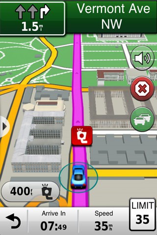
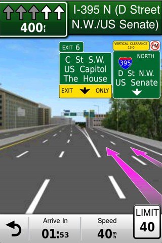
Garmin StreetPilot North America is packed full of great navigation features from Garmin, the world leader in GPS navigation. The app is the first iPhone navigation app to include Garmin's exclusive photoReal images of complex junctions to help you navigate with confidence. It also includes rich mapping with detailed 3D buildings and landmarks, lane guidance, speed/red light camera alerts and many other advanced features, while remaining simple and easy to use.
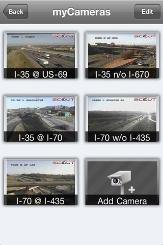
Optional in-app purchases include integrated real-time traffic updates, photoLive traffic cameras and fuel pricing.
Features:
• Industry-leading Garmin user interface
• Voice-prompted, turn-by-turn directions including spoken street names
• Millions of preloaded points of interest including gas stations, restaurants and other businesses
• Integrated Google™ Local Search
• Maps for the U.S.A., Canada and Mexico installed on your device, so wireless coverage is not required to navigate
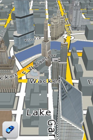
• 3D buildings and landmarks
• Lane assist with photoReal junction view provides a photo-realistic illustration of the correct lane for different maneuvers
• Integrated red light and speed camera database including community-generated alerts (U.S. & Canada)
• Speed limits for most major roads with the capability to report speed limit changes or errors
• Where Am I? emergency locator shows your exact latitude and longitude, the nearest address and intersection, and the closest hospitals, police stations and gas stations
• Exit services allow you to quickly see services such as restaurants, gas stations and lodging available at exits along your route
• Trip planner allows you to create a route with multiple stops in advance with automatic or manual ordering of destinations
• Address book integration so you can easily navigate to contacts
• Trip computer includes a compass heading and bearing indicator, resettable odometer and trip statistics such as arrival distance, next turn time and average moving speed
• Trip log enables an electronic breadcrumb trail that shows you where you've been
• Weather feature shows current conditions and a 5-day forecast
• Location sharing via Facebook or SMS
What's New In This Version:
- iOS 6 and iPhone 5 support
- URBAN GUIDANCE considers public transportation options, such as subways, trams, busses and water taxis, when calculating pedestrian routes. You will be guided to a transit stop by foot and you're able to look up detailed information on what line to take and where to get off. The feature is available through In App Purchase.
- PANORAMA VIEW 3D provides true 3D elevation views obtained from NASA's height and terrain data enable intuitive orientation and show users what lies ahead. Panorama View 3D is available through In App Purchase.
- GOOGLE STREET VIEW provides users a street-level view of their destination before starting a route and shortly before arriving. Users can also look at a full-screen 360° view to get a better understanding of their destination's surroundings. The feature is available in cities with Google Street View coverage.
You can purchase Garmin N. America from the App Store for $44.99.

You can follow Limerain on Twitter, Facebook, or RSS to be notified of any updates.
*thanks iclarified *
Send us a story or tip @ TipsForLimerain.com@gmail.com and follow our pages for the latest limera1n, rubyra1n, and all tech stories, follow us on Twitter at @iphonepixelpost or @limerain_com
And like our Facebook page www.iPodSets.com
- Posted using my iPhone 4
No comments:
Post a Comment